It is less and less possible to talk about trends in Earth observation (EO) and satellite data exploitation without considering Artificial Intelligence (AI).
- First, it is hard to keep up with the amount of satellite imagery available today, with various established providers managing PetaBytes of data. Some operators have even mentioned managing up to 1.3 million 29-megapixel images every day. That’s close to 40 billion pixels a day! Furthermore, data across different sources vary in swath, resolution, sensors (radar and optical) and product specifications. This results in an unprecedented amount of heterogeneous images being available with not enough human forces to deal with it.
- Second, start-ups aim at launching further EO constellations, adding new assets in space and notably exploiting technology progress in nano-satellites.
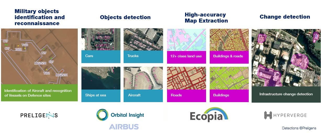
- In parallel, many actors and start-ups are developing AI that can be applied to imagery. They are working hard to deliver accurate analytics to quickly and easily extract a first level of satellite image analysis. Analytics can be used today for a variety of operational and mature applications such as mapping, monitoring, detection and counting of specific objects, change detection, and many more.
OneAtlas: the one-stop shop for both images and analytics
As the most extensive EO constellation operator, Airbus is particularly sensitive to this topic as AI allows to extract insight, more rapidly and on more data. Having this in mind, Airbus has partnered with some key companies to answer the swift data exploitation challenge and in doing so, support companies that are developing these capabilities.
Through the OneAtlas platform, Airbus gives access to all its optical archive available from 2012 (SPOT 1.50m, Pléiades 50cm, and Pléiades Neo 30cm and soon radar) but more importantly, to the best analytics delivered by companies worldwide such as Ecopia, Hyperverge, Orbital Insight and Preligens.
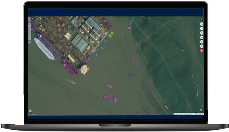
More concretely, OneAtlas users can run these analytics over any point on Earth. They can search and select the images they need and choose between a portfolio of analytics that they can apply on the selected images.


Artificial Intelligence training with Airbus
Now how does Airbus support the development of such analytics?
Beyond marketing and selling mature analytics, Airbus is also supporting companies who wish to qualify their analytics using our imagery. Indeed, we give an unlimited access to our data to be used as a trained dataset and therefore to improve the accuracy of the analytics. Companies benefit from a unique access to a variety of data covering the entire world, to feed machine learning which in turn improves the quality of the result of the analytics. Airbus also takes this opportunity to develop and test its own analytics, which allows to create a relevant testing environment and understand the challenges linked to training analytics.
In such a complex and growing data environment, there are so many analytics yet to be developed! At Airbus, we are convinced that collaboration is essential to foster innovation and support companies developing solutions in nascent and promising markets.


