Home
Newsroom
Case Studies
Pléiades Neo
The Metaverse Requires Very Hi...
The Metaverse Requires Very High Resolution, Spatially Accurate, Timely Geospatial Data
‘Metaverse’ is a catch-all term that describes a fully immersive, virtual 3D world where visitors can interact with their surroundings and each other, often through the use of VR headsets or advanced visualization and simulation software. The most prominent variations of this definition hinge on whether the created worlds are representations of reality, fiction, or something in between.

While the geospatial profession can’t dismiss the fictitious online worlds of video games as unimportant since so many are built with our data, the metaverses we should be focused on now are the ones that will be used for professional, predominantly non-recreational, applications. These virtual worlds will be digital twins of the entire Earth, faithfully representing the exact 3D appearances and precise locations of the physical terrain and man-made features.
Serious metaverse applications are many, but the most important involve visualization, modeling, and simulation in a safe digital environment. Visualization allows a city worker to walk down a virtual street and take inventory of municipal assets. Modeling lets a builder see how a planned house will look on an empty lot. And simulations enable engineers to determine how different street designs impact water runoff in heavy rains.
The advantages of these applications are limitless. The time and money savings of a virtual visit to the field versus an in-person one are significant, and from a GEOINT perspective, a virtual mission rehearsal can be the difference between life and death. Other modeling and simulation scenarios in the metaverse pay off in terms of reduced risk and better decision making by city planners, real estate developers, construction engineers, and many others.
For geospatial companies, the metaverse represents a tremendous opportunity because our products can, and will, provide the lion’s share of spatial and textural information with which these virtual worlds will be built. The locations, appearances, conditions, and sizes of buildings, streets and airports can be extracted from our imagery, as can features of the natural environment. And our elevation models provide that third dimension, or Z value, to all objects and surfaces, creating a truly realistic 3D experience.

30cm resolution image over a large highway intersection in Los Angeles.
What the Metaverse needs from us
With opportunity comes challenge. Meeting the data demands of the metaverse will not be easy, nor will they be unique. Realism is key. To adequately portray the real world in an up-to-date manner, geospatial companies will be asked to deliver massive quantities of data that are visually detailed, spatially accurate, and timely. These metaverse requirements are the same as many current applications of geospatial data.
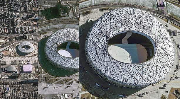
Virtually reproducing the realistic appearance of features relies on quality imagery with very high spatial resolution and precise accuracy. With our constellation of optical imaging and radar satellites, Airbus is well positioned to meet the needs of the metaverse today. The 30cm resolution of our Pléiades Neo imagery is the highest resolution satellite data on the commercial market today, making it possible to discern, identify, and measure objects small enough for a person (or avatar) to hold in their hand.
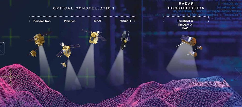
The Airbus Earth observation constellation currently includes: Pléiades Neo 30cm, Pléiades 50cm, and SPOT 1.5m optical satellites and radar satellites ranging in resolution from 25cm to 40m. Now under development by Airbus is the CO3D constellation that will deliver 50cm optical stereo imagery for creating global high-resolution 3D data sets.
A truly 3D experience necessitates that features must have realistic appearances from all sides and angles. The Pléiades Neo satellites can deliver this – swiveling in orbit to capture oblique imagery from a multitude of perspectives to create 360-degree 3D views of features such as a building facade or cliff face - a necessity for building a truly immersive virtual environment.
The accuracy of point locations will be just as critical in the metaverse as the real world. The Pléiades Neo orthorectified imagery reaches a 3 to 5 meter planimetric accuracy globally, thanks to the unique Airbus worldwide reference layer set made of highly accurate 3D ground control points, called Space Reference Points (SRPs), and elevation model called WorlDEM4Ortho.
To reach sub-meter vertical accuracy in orthorectified imagery, our geometric processing workflow uses the WorldDEM4Ortho elevation model from the Airbus WorldDEM product portfolio. These include Digital Terrain Models and Digital Surface Models generated from the Airbus TerraSAR-X and TanDEM-X satellite radar missions.
It should be noted that WorldDEM products are available as a standalone product that can serve as a worldwide elevation reference layer upon which to build a global digital twin.
The third data requirement of the metaverse is timeliness. A metaverse that is globally updated every 24 hours using very high-resolution satellite imagery is not possible now, but Airbus is able to deliver refresh data for regions of the globe with reliable frequency. The two Pléiades Neo satellites working together capture revisit imagery on a daily basis anywhere on Earth. Intraday revisits are possible when the Pléiades and SPOT satellites are utilized, at 50cm and 1.5m resolutions.
Acquisition timeliness is also driven by tasking turnaround and satellite capacity. The OneAtlas platform allows customers to place direct tasking orders as little as 25 minutes prior to satellite overpass, with products delivered as soon as two hours after collection.
Each Pléiades Neo satellite can capture up to 500,000 square kilometers per day. The WorldDEM products are globally off-the-shelf available within OneAtlas and ready for download in just a few seconds.
Also important for data timeliness is the availability of the Airbus satellites, which are 100 percent company owned and dedicated to commercial acquisitions.
This means private-sector customers are always first in line for data acquisitions. Although a global metaverse isn’t here yet, the geospatial data sets needed to build and maintain it are here now. With our constellation of optical and radar satellites in orbit now and a new imaging program under development, Airbus is able to deliver geospatial data with the right combination of spatial resolution, accuracy, and refresh rate to meet the ambitious data requirements of metaverses today and tomorrow.
Image 1: From left to right: 1.5m, 50cm and 30cm resolution imagery over Beijing National Stadium.
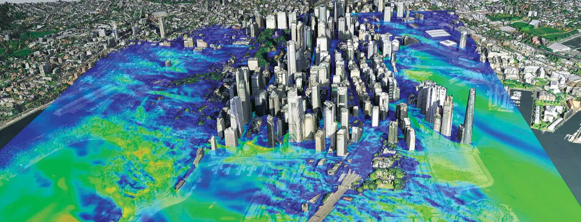
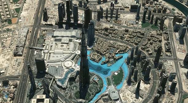
Image 2: 3D mesh model of Dubai produced with 50cm resolution imagery from Airbus.
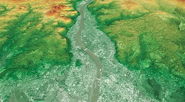
Image 3: WorldDEM Neo over Bonn, Germany
Want to know more?
Our sales team will be happy to provide you more information about this case study and how it can meet your business needs.
