Home
Newsroom
Case Studies
Pléiades
Signal Activity Identification...
Signal Activity Identification over Iran
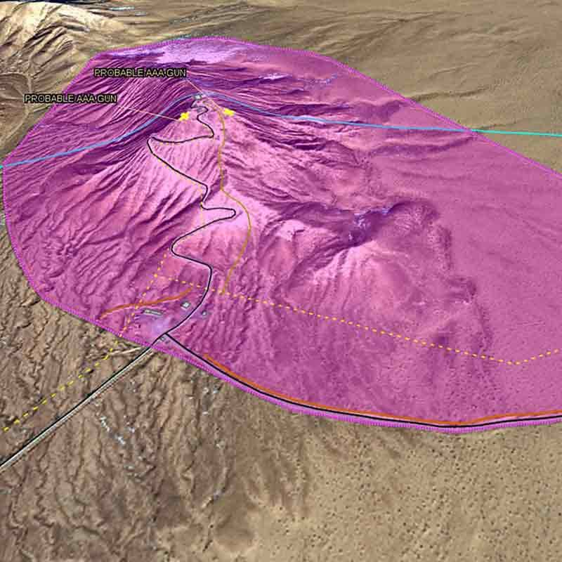
This tip-and-cueing Multi-Int analysis shows a probable P-18 Spoon Rest signal identification in a remote area.
Challenge
There are a multitude of radio frequency signals and most of them are very difficult to identify with traditional means. Radio frequency signal localisation is necessary to identify the location of unknown radio frequency sites and support mission planning before operation.
In support of RF signal identification, Earth observation satellites can provide value-added information and high-detail analysis. This tip and cue analysis is vital to satisfying several missions:
- Protect borders
- Monitor sites for signal activity
- Geolocate emitters in GPS denied environments
- Identify interfering sources
- Detect change and anomalous behavior
- Conduct broad surveys of RF activity

Our solution
In response to these challenges, the Airbus analyst team has developed a cross-cueing analysis capability, combining Airbus’s earth observation satellites and Hawkeye 360 RF geolocation data over Iran.
First, Airbus analysts started identifying military sites in Iran and asked Hawkeye 360 to conduct experimental monitoring for those areas of interest. Following an acquisition made by Hawkeye 360 team, they identified a unique signal at 153 MHz within a remote location where nothing had been identified before. Then, Airbus experts tasked Pléiades satellites to supporting this intelligence with high-detail satellite imagery of the sites.
This combined analysis demonstrated that radio frequency data can send alerts when a VHF signal is located and provides RF activity monitoring over sensitive sites. Hawkeye 360 identified potential RF activity over an Area of Interest, and Airbus confirmed that there was an EW radar (P-18 SPOON REST probable) at that location.
Tip-and-cueing Multi-INT analysis for unprecedented global situational awareness
Want to know more?
Our sales team will be happy to provide you more information about this case study and how it can meet your business needs.


