Home
Newsroom
Case Studies
Pléiades Neo
Pléiades Neo supports water ma...
Water Management and Protection from Space with Pléiades Neo
Read the insights of our partner DHI
The Pléiades Neo Constellation unlocks new possibilities for enhanced water management and protection from space. This new constellation brings an unrivalled level of detail and accuracy with the addition of the deep blue band. Indeed, it can be used for both hydrological and bathymetry applications, allowing deeper penetration in water bodies and a clearer understanding of underwater relief.
Applying new satellite technology solutions, our partner DHI frequently monitors critical habitats worldwide and keeps track of remote, vast, dynamic and inaccessible areas in high spatiotemporal detail.
Here they show an example from Florida, US where our new Airbus’ Pléiades Neo data was applied to derive key parameters to underpin conservation management efforts.
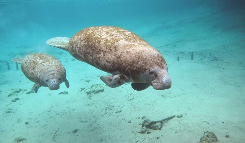
The state of Florida is one of the most biodiverse regions of America and home to more than eighty distinct ecosystems and a wide diversity of different plant and animal species. However, Florida’s ecosystems are increasingly under threat from human activity, climate change and natural processes, not least its coastal regions which are home to many endangered species that rely on healthy and well-functioning marine and coastal ecosystems.
Figure 1, In 2021, a record high 1001 manatees in Florida died, not least due to starvation caused by loss of SAV. As a result, Florida Wildlife officials started a campaign feeding starving manatees with lettuce in early 2022.
Florida’s coastal waters are some of the most productive and diverse ecosystems, often dominated by submerged aquatic vegetation (SAV). SAV includes a taxonomically diverse group of macroalgae and seagrasses that lives below the water surface in coastal and estuarine waters in large meadows, or smaller patches. The health of aquatic vegetation is a key indicator of the ecological status and environmental state of ocean and estuarine waters.
They provide critical functions which are difficult to replace, such as:
- Habitats, spawning grounds and food for many different marine species
- Adding oxygen to the water and remove excess CO2
- Improve water quality by absorbing excess nutrients
- Stabilise sediment and reduce erosion.
One of Florida’s most endangered species, the manatee, rely almost entirely on the extensive beds of seagrass and freshwater aquatic vegetation in the estuaries and freshwater lakes, springs and rivers. As the manatee’s primary food source, healthy and abundant SAV communities are a precondition to their survival – however Florida’s SAV communities are increasingly under threat, not least because of human disturbance and climate change. A record high 1,001 manatees died in 2021, largely due to starvation caused by loss and degradation of aquatic vegetation. As a result, Florida Wildlife officials started a campaign feeding starving manatees with lettuce in early 2022.
Due to the nature of their important ecosystem functions, up-to-date knowledge about SAV abundance, distribution, health and growth dynamics is critical, in order to assess the impacts of management efforts, identify degraded communities and monitor overall marine health. However, SAV communities are also highly fragmented in both time (in some locations changes occur within days and in others over weeks or months) and place (organised into many different heterogenous patches of individual communities) which makes SAV monitoring a challenging task. Traditionally, a combination of diver observations, photos and/or video recordings, to determine e.g., spatial coverage and species composition, have been used to monitor SAV habitats. However, these techniques are time consuming, labour intensive and highly limited in their spatial extent and thus unable to fully capture the spatiotemporal dynamics.
Modern satellite technology provides new avenues to underpin conservation efforts by addressing key limitations associated with existing monitoring techniques – providing a reliable, consistent, and cost-efficient alternative. With new very high-resolution (VHR) satellites sensors, such as Pléiades Neo from Airbus, it is now possible to frequently assess SAV communities both quantitatively (distribution, abundance and dynamics) and qualitatively (growth patterns and threats), at scale.
Pléiades Neo data can also be applied to accurately map shallow water bathymetry in high detail as well as monitor populations of large marine species, including manatees.
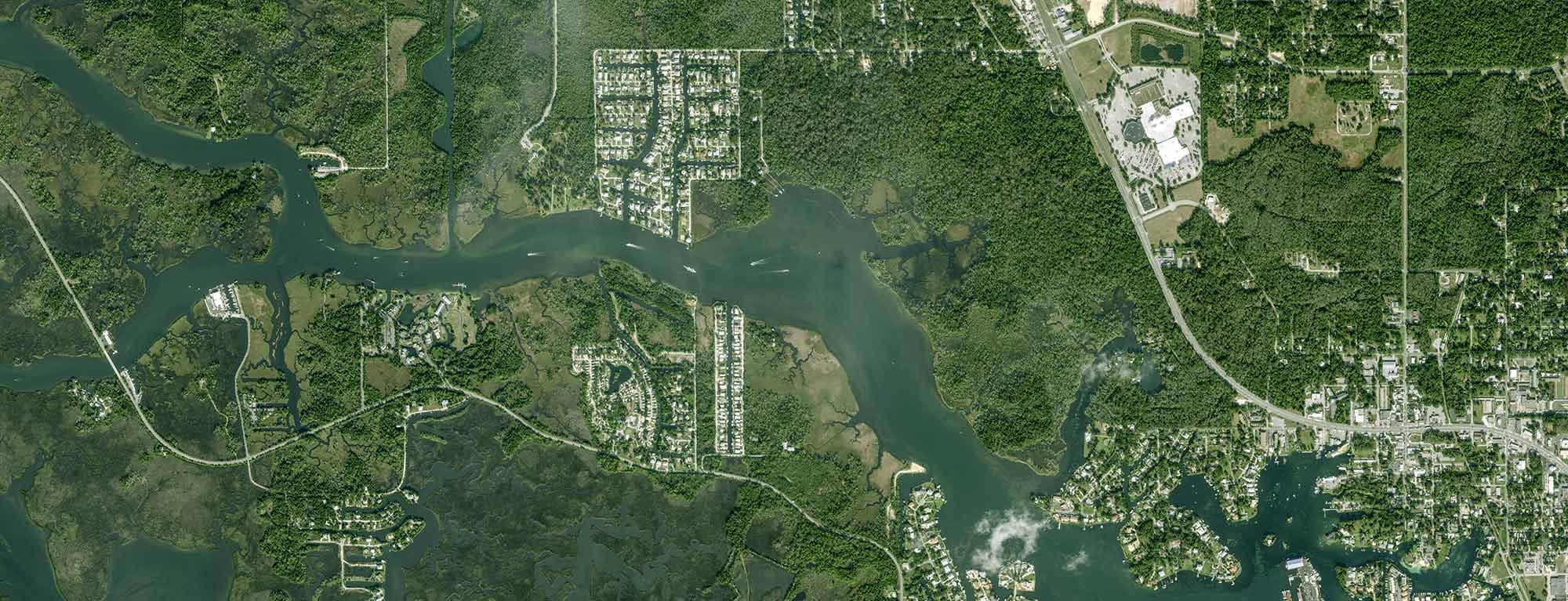
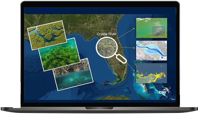
In this use case, DHI applied new Pléiades Neo 30cm data to test application potential and perspectives of using it as a VHR spatiotemporal source of data to map aquatic vegetation, water depths and objects (vessels and manatees) in and around Crystal River – the so-called manatee capital of Florida.
Figure 2, Applying new Pléiades Neo data to map and monitor SAV, water depths and manatee populations in Crystal River, Florida.
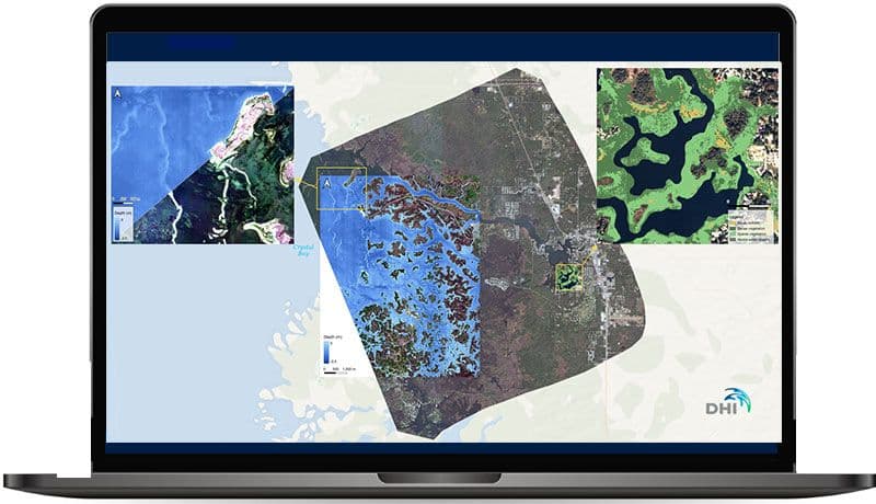
As seen from the illustration on the left, the derived Pléiades Neo based bathymetry and SAV products provides comprehensive and highly detailed insight into water depths in the shallow water coastal zone as well as SAV distribution and abundance in the Crystal River delta.
Figure 3, Pléiades Neo based bathymetry and SAV data provides highly detailed insight into coastal zone areas and aquatic vegetation communities
With its twice-daily revisit time, Pléiades Neo data can be applied to continuously map and monitor all Florida’s fragile coastal ecosystems, thus providing up-to-date insights into the growth and dynamics of SAV communities at scale.
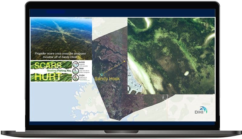
Furthermore, with a 30 cm resolution, Pléiades Neo data provides new opportunities for assessing qualitative SAV parameters, such as detecting and mapping impacts of propeller scars. These scars, caused by motorboats, are extremely detrimental to SAV communities across Florida’s coastal areas, and in order to underpin conservation efforts, it is vital to have comprehensive and up-to-date information on the areas where these scars occur as well as how they develop over time.
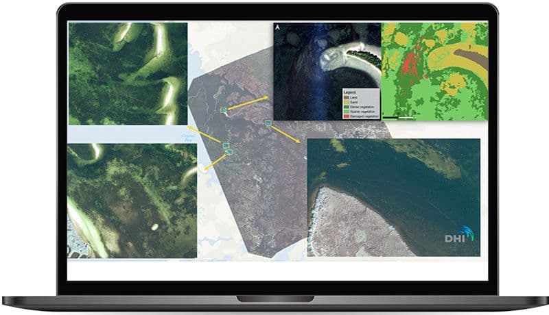
As seen from the illustrations below, Pléiades Neo 30cm data can be used to map and monitor these scars as they develop – thus providing authorities with a timely tool to evaluate threats and assess mitigation needs. In combination with the satellite-derived bathymetry data, the most vulnerable shallow water areas with exposed aquatic vegetation can also be easily identified and protected.
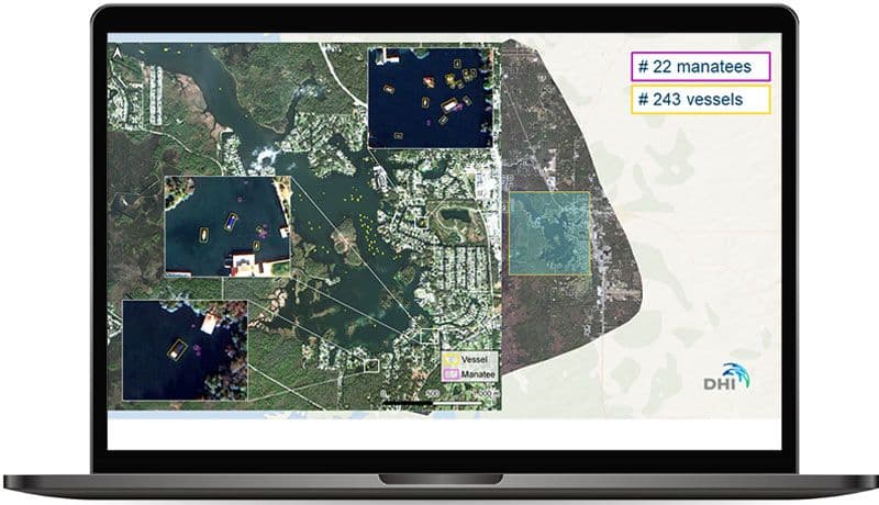
Lastly, Pléiades Neo data can be used to monitor objects, such as individual boats and manatees as illustrated in the example below from the inner Crystal River estuary. Using novel deep learning technology, such assessments can be conducted accurately, timely and at scale, for comprehensive monitoring of boat traffic density and dynamics as well as population assessments of manatees or other marine species (e.g., basin wide assessments of whales or whale sharks).
Image 1: Propeller scars of Sandy Hook as seen from the Pléiades Neo satellite image (right)
Image 2: Numerous propeller scars identified across the Crystal River region and an example of damaged vegetation mapping (top right)
Image 3: Vessels and manatees detected in the inner Crystal River estuary through the use of deep learning technology and Pléiades Neo data
DHI is among the world’s leading knowledge and technology providers within satellite remote sensing for hydrological and marine monitoring and risk management applications. With more than 20 years of experience in satellite remote sensing, DHI provides a leading satellite derived bathymetry (SDB) service, available through the Bathymetrics Data Portal, as well as user-friendly and scalable services to map and monitor submerged aquatic vegetation.
Authors: Mads Christensen. Associated institute: DHI GRAS A/S.
Want to know more?
Our sales team will be happy to provide you more information about this case study and how it can meet your business needs.
