
Home
Newsroom
Case Studies
Various
Building Society uses Airbus´ ...
Delivering Comprehensive Property Risk Solutions to Nationwide Building Society
Nationwide Building Society needed a tailored but affordable solution to update how they manage their property risk portfolio and improve customers’ experience. Nationwide selected Airbus as a strategic supplier with an equally innovative culture.
Considered one of the most stressful life experiences, the buying and selling of property is an infrequent transaction. Consequently, property buyers remain unaware of the inefficiencies within the mortgage lending process.
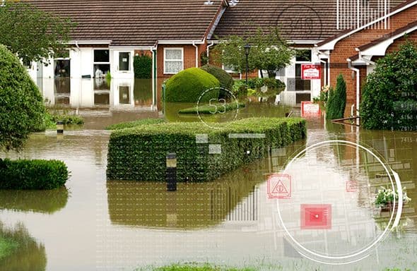
Key issues occur when insurers refuse to grant a building insurance policy on a property at high risk of flood, as the risk is usually identified at the final stages of the process. Both time and money have then been wasted by all parties.
Property conveyancers, valuers and underwriters each work in isolation and, as such, rarely share property information. This can lead to additional costs, risks to lenders, and ultimately delays to the customer during the purchase process. Currently, stakeholders make decisions based on assumptions, and undisclosed information leads to substandard customer service, rejected mortgage applications and futile monetary ties.
Our Solution
Nationwide Building Society, the second largest lender in the UK, needed a tailored but affordable solution to update how they manage their property risk portfolio and improve customers’ experience. Nationwide selected Airbus as a strategic supplier with an equally innovative culture. Airbus committed to innovating change in the mortgage market by delivering environmental risk data that supports mortgage Decisions In Principle (DIP).
Airbus supplied Nationwide with advanced datasets integrated from numerous relevant data providers. The result was a comprehensive and property-specific solution to support lending decisions based on the insurability of the property.
This provides a solution for mortgage lenders to make efficient and accurate environmental risk assessments at a property level.
Airbus supplies multiple geospatial datasets:
- All datasets are accessed on a secure online visualisation platform.
- Datasets are styled in a binary format for ease of use by the user.
- APIs allow additional data to be layered in continuously with built-in geo-processing.
- Information is updated every six weeks to enable the regular addition of data on new builds and to remain up to date.
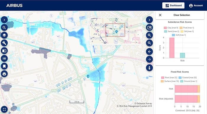
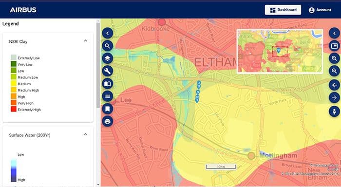
Every residential address in Great Britain is appended with:
- Image 1: A binary flood risk score
- Image 2: A binary subsidence risk score

Construction of a residential area
- Through a centralised data management process, lenders and underwriters can realise efficiencies whilst making immediate decisions on insurance and mortgage applications.
- Users quickly derive value from the vast archives of data delivered.
- Customer experience is improved by reducing wasted time and money. Quick decisions allow the customer to renegotiate the property purchase price or discontinue the transaction.
- Provides Nationwide with the data and platform from which to maintain and grow a lower risk mortgage portfolio and enhanced insurability for its customer’s homes.
Want to know more?
Our sales team will be happy to provide you more information about this case study and how it can meet your business needs.
