Home
Newsroom
Satellite Image Gallery
Various
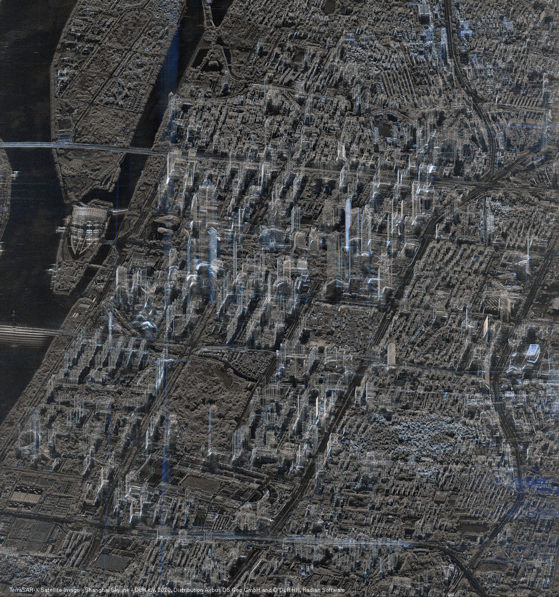
View of the Shanghai skyline f...
Sensor
VariousResolution
-
Location
Shanghai, China
Copyright
Airbus DS
Date
16 April 2020
Distribution
Image type
Radar
This high-resolution image of the Shanghai skyline was captured by the German TerraSAR-X radar satellite in April 2020. The image shows an accurate view of the city of Shanghai in microscopic detail. The latest satellite imagery depicts a layered footprint of the city with transparency of buildings, delivering a complete picture of the landscape.
The image depicts in fine detail numerous skyscrapers,bridges and other man-made structures that reflect the radar’s waves. This contrasts with the vegetation zone in the middle on the bottom left. When zoomed in, the image clearly shows trees, parks, roads, and fields. The Huangpu River that crosses Shanghai is visible on the left side of the image as are two of the three islands of Shanghai.
A radar image is a powerful tool that offers an in-depth perspective of any geographical location. Radar signals provide detailed images of the environment and man-made objects without dependence to day-light and weather. Radar imagery is an indispensable tool for disaster management, environmental monitoring, urban planning and resource exploration.
Airbus’s Radar Constellation transmits comprehensive information in real-time across large geographical areas. These areas are often remote and difficult to access or subject to mapping or scanning restrictions.
The benefits of radar imagery for industries are numerous and include:
- Informed decision-making using factual data.
- Cost and time savings due to a reduced need for field surveys and on-site visits.
- Optimisation of resources e.g. water management or route planning.
- Assessment of risk, e.g. natural disasters and environmental changes.
- Tracking of environmental impacts such as deforestation or pollution levels.
- Infrastructure management to plan maintenance and development.